ÇATALHÖYÜK 1998 ARCHIVE REPORT
| |
Introduction and Summary
Ian Hodder
Work this year began on 15 July and continued for two months. The team had over 90 people coming from a wide range of countries to join 35 local Turkish workers and 15 Turkish students, 5 from Selcuk University in Konya. The team members were from United States, Britain, Germany, Yugoslavia, Denmark, Sweden and South Africa. Close collaboration has now been started with a large number of Turkish researchers from METU (ODTU). The Main Sponsors in 1998 are Visa International, Boeing and Koçbank. The Long-Term Sponsor is Merko, and the Co-Sponsors are British Airways, Glaxo-Wellcome and Shell. Funding was also obtained from the Newton Trust, British Academy, British Institute of Archaeology at Ankara. The Friends of Çatalhöyük provided financial support for Turkish students, and also arranged a visit by Jimmy and Arlette Mellaart for whose support of the project we are greatly indebted. The project operates with a permit provided by the Turkish Ministry of Culture, Directorate General of Monuments and Museums, and under the auspices of the British Institute of Archaeology at Ankara. The project owes much gratitude to Konya Museum and its Director Erdogan Erol.With the aid of the sponsorship described above, we have this year added living accommodation and KoçBank has added a Visitor Centre (Çatalhöyük Evi) to the dig house at the site. The dig house now contains three stores, 5 laboratories, and accommodation and eating facilities. The Visitor Centre has been partially provided with displays this year, and the displays will be completed in 1999. Bricks have been made for an experimental reconstruction of a house, which can also be visited by tourists. We are preparing Building 5 (see below) for visitor access, and we have printed a booklet about the site available in Ankara and Konya Museums and at the site.
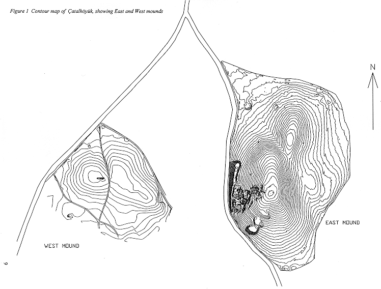
Excavations this year took place in two areas on the north part of the East mound (Bach and North), in the Mellaart area, and on the West mound (see Figure 1). In the Bach area, excavation continued in Building 3 (Mellaart Levels V/VI). This is divided by a partition wall into Spaces 158 and 86. F155 may represent a collapsed sculpture from the partition wall. Painted walls and complex plaster-work have been found (red around platform F154 and black on the south wall). There is also the first collapsed roof (F157) found at the site. This shows the type of activities that were taking place on the roofs of the houses in the summers. Hearths were on the roofs and many domestic activities took place there. The roof had collapsed onto a 'bucranium' (bull's horns and skull) placed on the floor. An intrusive Roman burial (F158) was excavated.
In the North excavation area, Building 5 has been discovered beneath Building 1. Building 5 (Mellaart Level VI/VII) has very well preserved plaster. It has a large central room (Space 154), a smaller room to the east (Space 155) and two rooms to the west (Spaces 156 and 157). On the south wall of the main central room there are clear traces of the ladder which allowed access through the smoke hole above the fire. There are large pits in the floors and scars on the walls - these are the traces of wooden posts which were pulled out when the building was abandoned. There are initial indications of red painting on the plaster walls in this main room. There is a small hole to allow food to be passed between the main room and the eastern room (Space 155) which has two small plaster basins. Space 157 contained seven storage bins. Space 156 contained poorly made floors.
In the Mellaart area several houses and rubbish areas are being excavated. In Building 2 (Space 105), the floors were excavated in a building defined last year (Mellaart Levels VIII/IX). Three ovens replaced each other over a complex period of replastering the floors. There are platforms on the west and east walls. In Space 112, the burials of 12 skeletons have been excavated in 1997 and 1998. Building 4 in Space 113 consists of a small room (Space 150) in the southeast corner with basins which was later blocked. In Space 151 there was a series of three ovens. An external midden (rubbish) area (Space 115) was excavated beneath the buildings (Spaces 106-8). Unusually a burial occurred in this external area. Space 159 was also excavated. This is a side room for 'Shrine 10' and it contained the claw of a bear.
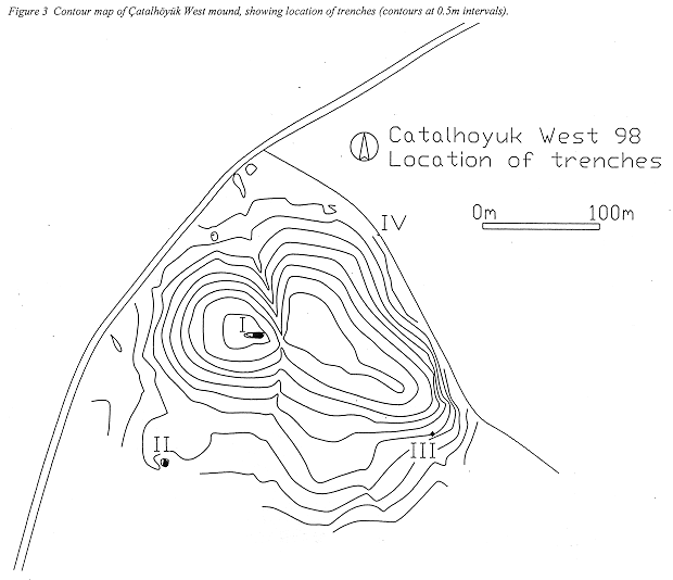
Work has also started on the later West mound. In Trench 1 the corner of a mudbrick building was found and there are fragments of red painted plaster. A collection of horned pot-stands was found in the fill of this building. In Trench II a large pit was found with a large amount of painted pottery.
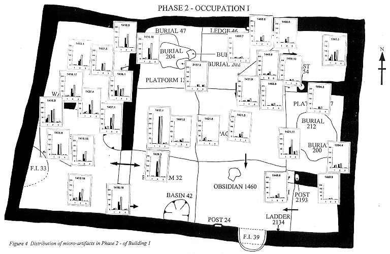
In terms of methodology, we have continued to use the approach developed in previous years, including piority tours, video recording, diary writing (although this was less systematically carried out this year). In addition 'lab tours' and 'space tours' were introduced, the latter allowing more thematic discussion of issues in the context of particular 'spaces' or buildings on the site. The presence of additional specialists, especially phytolith and chemical trace analysis, proved extremely useful, and their plans to introduce on-site methods are welcomed. Sampling of floors continued in intensive mode, and some interesting patterns have begun to emerge from the earlier excavation of Building 1.
Indeed, we are beginning to observe clear indications of variation in patterning in the use of floors. Often the boundaries between different types of use of different platforms or parts of floors are marked by ridges and plaster edges, or even by walls. The distinct boundaries between zones of activities on the floors may partly have been produced by differential matting. Even so, the degree of separation between different areas suggests restrictions on movement. There is also evidence from the burial data that different social groups (young versus old etc) were associated with different parts of the houses. It seems likely that the houses were divided into distinct areas, with certain people only allowed to sit, eat, prepare food etc on certain platforms. We are gaining a sense of well defined routines in the organisation of daily life. These may have extended to the use of the roofs too - the example from Building 3 appears to show similar differentiation.
Also remarkable is the repetition of these patterns of use over time. While change in use through time certainly occurs, the overall impression is of repetition, year by year, of the activities and uses of different parts of floors. This strong sense of continuity is only broken when the building is carefully abandoned. The emphasis on careful abandonment procedures runs as a theme throughout this report. We are beginning to discern variation in the abandonment procedures, although as yet the sample of buildings is too small to allow inferences to be drawn about the reasons for different abandonment practices. In some cases, the fills of buildings are very clean and there is evidence of deliberate filling in of ovens and dismantling of upright posts. In other cases, there is more evidence of collapse and decay. It may be the case that the more deliberate fills occur in buildings which were to be built upon immediately. Collapse has been mainly found where the building went out of use (Buildings 1,2,3).
We have also begun to observe major variation between buildings. Building 3 is by far the most elaborate so far excavated. In some cases (eg Building 1) large numbers of burials occurred. In others, very few. Some have traces of painting and sculpture (eg Building 1) while others do not (Building 5). It will be necessary to excavate larger numbers of contiguous buildings before such patterns can be explored further.
Conclusion
Overall, the micro-scale analysis of this project is possible because a larger-scale picture was established by James Mellaart in the 1960s. We are now beginning to see the fruits of a more detailed and micro- approach. The rich preservation of floors and behavioural information on them provides the potential for in-depth understanding of the ways the buildings were used. Variation across space and time can begin to show us the ways in which the society at Çatalhöyük was organised. The use of environmental resources can be set within a rich tapestry of social and cultural practices. While this archive report begins to weave some of this story, we plan to have a study season in 2000 so that full analysis and publication of the work so far can be achieved.Figure 1 Contour map of Çatalhöyük, showing East and West mounds
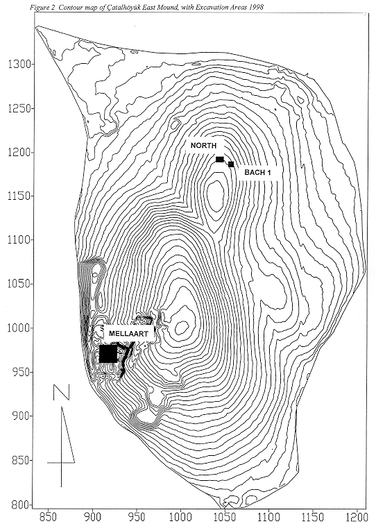
Figure 2 Contour map of Çatalhöyük East Mound, with Excavation Areas 1998
Figure 3 Contour map of Çatalhöyük West mound, showing location of trenches (contours at 0.5m intervals).
Figure 4 Distribution of micro-artifacts in Phase 2 - of Building 1
| |
© Çatalhöyük Research Project and individual authors, 1998